A Royal Australian Air Force E-7A Wedgetail prior to a flight during Operation Kudu, Germany (Defence Australia)
WASHINGTON — By the early 2030s, the Space Force hopes to have satellites equipped with sensors to target aircraft in the hands of operators, according to the service’s second in command, Gen. Michael Guetlein.
Satellites equipped with Air Moving Target Indicators (AMTI), which would send precise tracking data to “shooters” on the ground, at sea and in the air, would be a new capability — joining the Space Force’s joint program with the National Reconnaissance Office (NRO) to develop Ground Moving Target Indicator (GMTI) satellites that track vehicles and ships.
“I would say you’re looking at probably early ’30s for some of that capability to start coming online, both for GMTI and for AMTI,” Guetlein told the annual Defense News conference today.
“The adversary has become very good at pushing the lines of battle further and further out away from their shores, and have become very good at denying oversight of their territory. As they’ve done that, we’ve had to go higher and higher to get the same perspective of what’s going on on the battlefield,” Guetlein explained. “So, as we push to GMTI — that’s your larger moving targets — we also know we need to get after air moving targets. So we are starting to invest in those studies now, and in those conversations.”
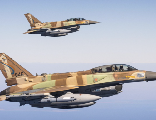
Up to now, Space Force leaders have been somewhat coy about their plans for space-based AMTI — a job that currently is accomplished by the Air Force’s fleet of aging E-3 Sentry Airborne Warning and Control System. The Air Force in 2022 decided that Boeing’s E-7 Wedgetail aircraft would become the primary replacement for the E-3s, and last month finally reached a $2.6 billion deal with the company to acquire the first two E-7 of a planned 26 planes.
By contrast, the Space Force since 2021 has been pushing their case to fill part of the gap in ground tracking/targeting left by the Air Force’s retirement of the E-8 Joint Surveillance Target Attack Radar System (JSTARS) aircraft. That campaign has run up against roles and missions related challenges — some of which have yet to be fully resolved — from both the NRO and the National Geospatial Intelligence Agency (NGA). The NRO owns and operates the nation’s spy satellites, while the NGA is responsible for disseminating space-based intelligence, surveillance and reconnaissance (ISR) imagery and analysis to users across the US government.
Guetlein said that he sees the mission for tracking both types of targets being accomplished through a multilayered architecture of sensors in space and on platforms that can get closer in to take more detailed images — presumably including aircraft.
“I see it always being a layered set of capabilities to increase survivability, first and foremost, but also the closer I can come to the target, the more resolution I get on the target. As I move to space, it becomes harder and harder to get that same same level of resolution on a target that I may be required,” he explained.
While Guetlein didn’t go into details, one of the key challenges for tracking enemy aircraft from space is that airplanes and drones move much faster than tanks, trucks and ships. This is compounded by the fact that to be best able to take high-quality pictures or establish radar images of objects on the ground or in the air, satellites would have to be stationed in low Earth orbit where they themselves move around the Earth at about 7.8 kilometers per second (4.8 miles per second); i.e., about 28,000 kilometers per hour (17,000 mph).


