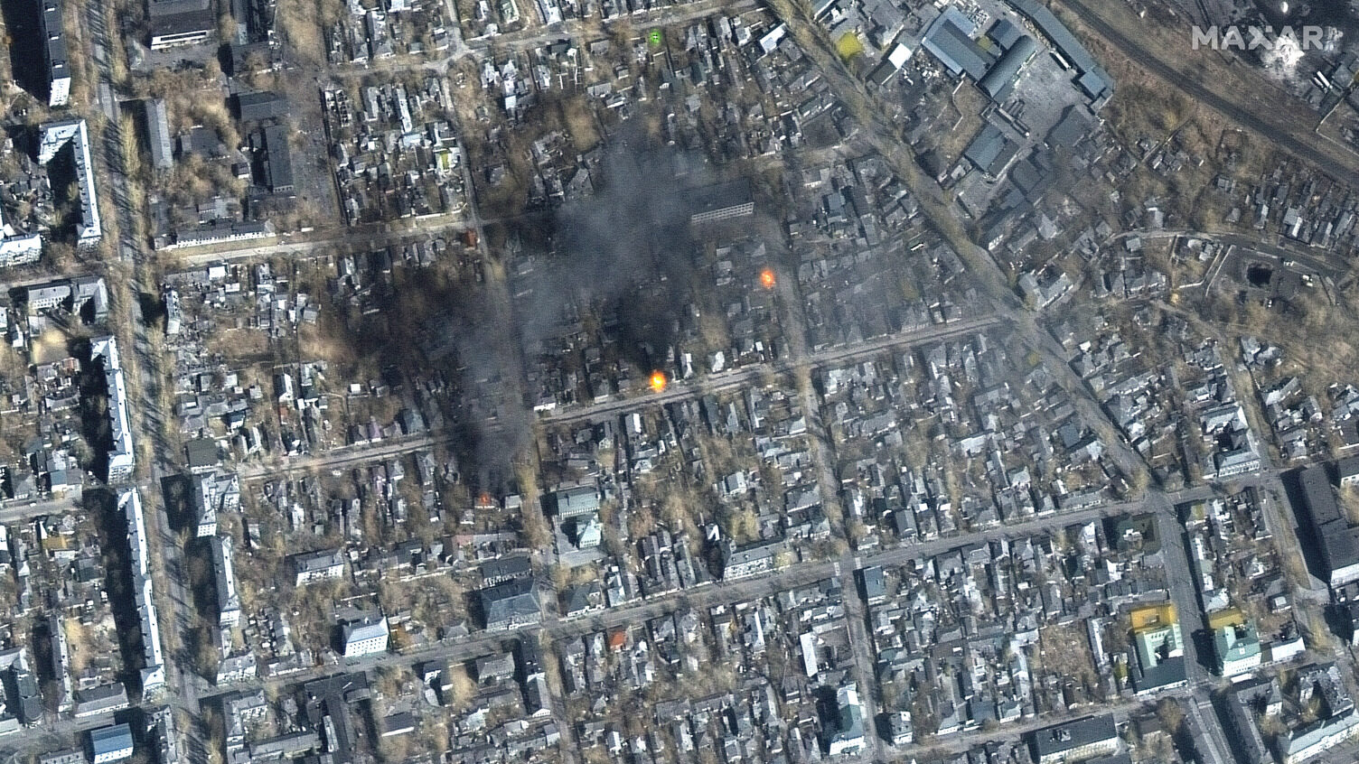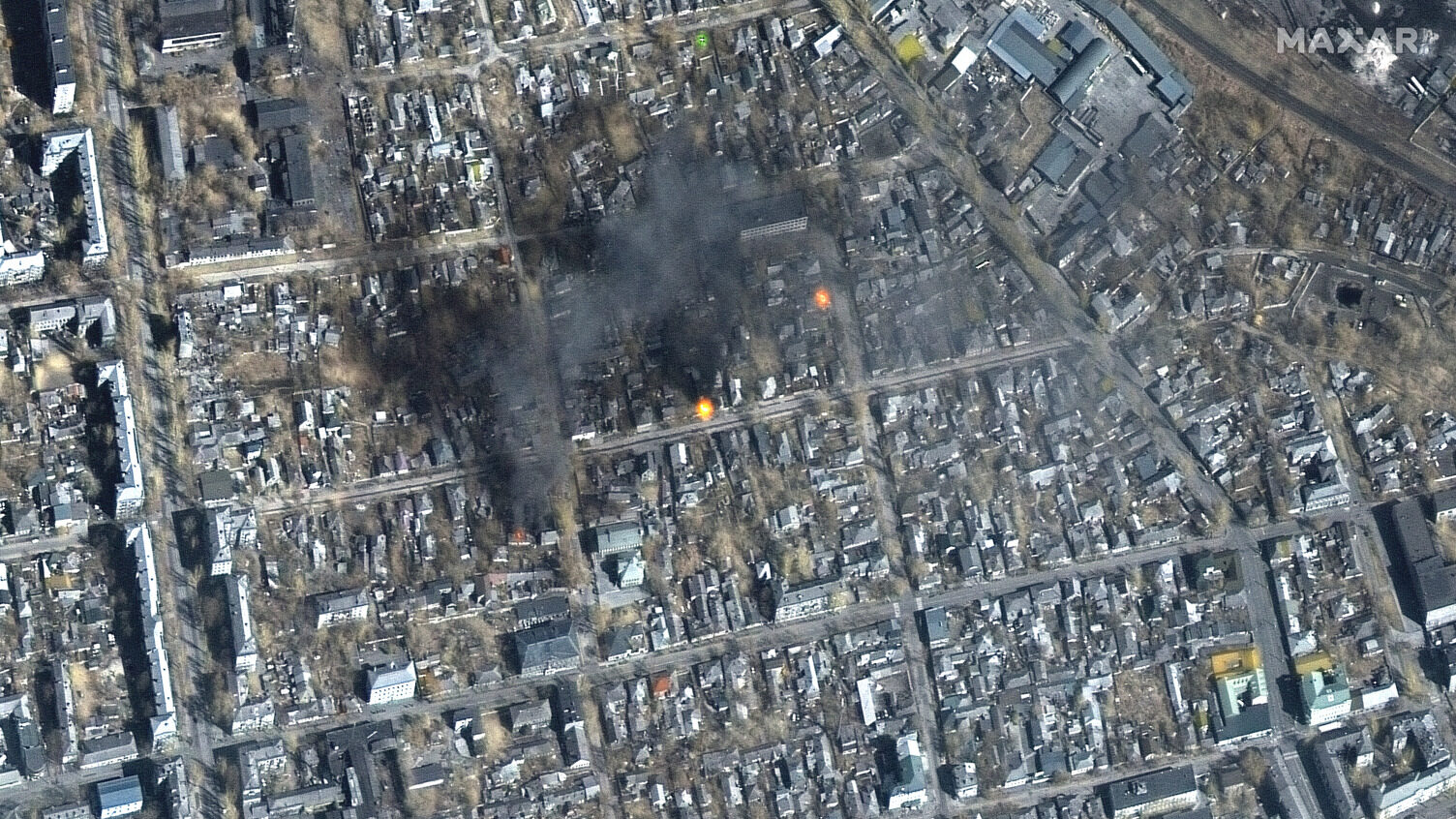
Satellite imagery taken by Maxar on March 14, 2022, shows damage in the southern Ukrainian city of Mariupol. (Courtesy Maxar)
BELFAST — The Netherlands has committed to modernizing its space-based sensing and intelligence, surveillance and reconnaissance (ISR) capabilities after signing two contracts this month with Europe’s Airbus and US-based Maxar.
“These contracts are established for the renewal and improvement of the current direct access satellite imagery platforms used by the [Ministry of Defense],” a Dutch MoD spokesperson told Breaking Defense.
The new four-year partnership with Airbus, the value of which was not disclosed, covers access to the manufacturer’s OneAtlas satellite data platform that opens up an “extensive suite of capabilities including optical, radar, and elevation data,” according to a company statement.
It shared that from an optical perspective, operational benefits will include access to remote sensing satellite constellations SPOT, Pléiades and Pléiades Neo archive imagery, highly reactive tasking and high-resolution images in the range of 1.5m to 30cm “native” resolution and enhanced visual rendering of Pléiades Neo HD15 images. Native resolution refers to image clarity before computer enhancement.
Additionally, The Hague will also gain access to the Airbus Radar Constellation, delivering data from three satellites, ranging from 25cm to 40m resolution.
“Radar imagery can be collected independent of weather and daylight conditions over any point on Earth and is especially suited for increased acquisition capacity, improved global mean revisit time and a significantly reduced interferometric repetition cycle to support data-intensive, high-frequency surveillance applications,” added Airbus.
In line with aiding information-rich activities like mission planning and disaster response operations, the Airbus package also includes digital elevation models, primarily optical-based elevation and 3D textured models. Elevation data is particularly critical for making accurate 3D terrain maps.
“The OneAtlas platform offers a global image dataset, satellite tasking options as well as radar, 3D and analytics, ensuring that military and civilian personnel within the Dutch Ministry of Defence have access to up-to-date, high-resolution satellite imagery and geospatial information for operational planning and mission monitoring,” noted the manufacturer.
Getting To Grips With Geospatial Data
Meanwhile the Maxar contract, valued at €13.6 million ($14.4million), revolves around a four-year subscription to Maxar Geospatial Platform (MGP) Pro and supporting geospatial solutions, according to a company statement.
“Under the competitive framework agreement, Maxar will help the MoD’s Defence Geographic Agency (DGA) and its hundreds of users enrich the agency’s geospatial foundational data and derivative product portfolio in support of its mapping, intelligence and operational support missions,” the statement said.
Maxar said that MGP Pro offers “on-demand access to the world’s most recent high-accuracy, high-resolution satellite imagery and analytics in a single, powerful platform.”
The geospatial solution also hosts a 125-petabyte imagery archive and end users can task satellites, access 3D data and use AI or machine learning tools for object detection.
The Netherlands will also receive access to “three million sq km of daily 30cm-class resolution image collections, in addition to over 6 billion sq km of archived imagery at up to 30cm resolution,” noted the US firm.
As mentioned by the Netherlands MoD spokesperson, the development of “sovereign capabilities” to strengthen space-based ISR capabilities remains a key priority for the department.
“The current focus is on those capabilities that are relevant for the Dutch armed forces,” that are aligned to “cooperation in international partnerships, and where the Netherlands industry and knowledge institutes (already) have an advantageous international position.”
At a more general level, Dutch space capabilities are developed around and delivered against NATO capability targets, or in conjunction with European Union and international partners. While the US currently provides most ISR imagery and data analysis to NATO, the 32 members states are in the midst of an effort to beef up capacity from other countries.
“In international cooperation, we are focusing on innovative space solutions for ISR and other space functional areas (such as space domain awareness or space-based early warning), with relevant partner nations,” added the Dutch MoD spokesperson.
Space technology is listed as one of five key areas where Dutch defense companies “excel” and has been selected for “targeted” investment, under plans disclosed by The Hague, from within its Defence White Paper [PDF], published in 2024.


