
The orbital population of active and inactive satellites continues to grow, especially in low Earth orbit. (Image credit: NASA)
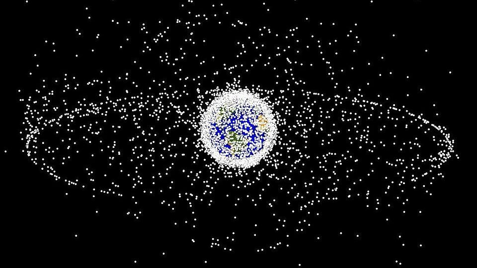
AMOS 2024 — Space is supposed to be big, “vastly, hugely, mind-bogglingly big,” as a wise man once said. But low Earth orbit (LEO), where most satellites now linger, is not as big as it may seem. And with thousands of satellites floating there now and tens of thousands more on the way, there will be, eventually, no room left.
When that will happen is unclear, but a new study by MITRE takes a stab at establishing a framework to determine at what point does the sheer volume of space traffic in LEO overwhelm the environment — making it impossible for satellites to function due to interference and the risk of collision with each other and orbiting debris.
The study, called “Integrating Orbital Carrying Capacity into International Policy Constructs: Leveraging Best Practices from Aviation’s Risk-Based Norms,” is based on adapting the approach the international air traffic control system uses to manage airspace to prevent planes from colliding, said Kevin Toner, vice president of MITRE’s Center for Government Effectiveness and Modernization.
Toner, along with several other MITRE officials, spoke with Breaking Defense on Monday on the margins of the annual Advanced Maui Optical and Space Surveillance Technologies (AMOS) conference. The paper, the officials explained, will be presented in full at the 75th International Astronautical Conference in October.
As the number of satellites in LEO, roughly 300-2,000 kilometers above the Earth, continues to skyrocket global concerns are growing about what is known as “carrying capacity” in the orbital regime have also grown. Like any physical space, LEO has a limited capacity, meaning there’s only so much room for satellites without significantly increasing the chance deadly on-orbit crashes — which in turn create more space junk that can crash into other things.
For example, the issue of LEO crowding and concerns about equitable access for developing countries came to the fore at the March meeting of the Science and Technical Subcommittee of the UN Committee on the Peaceful Uses of Outer Space (COPUOS). The primary source of worry is the plethora of mega-constellations comprising thousands of satellites being launched by commercial companies and governments, including militaries, around the world.
SpaceX alone has already put some 6,000 Starlink satellites in LEO, and hopes to expand its broadband network to over 40,000. The company also is launching hundreds of its militarized Starlink, called Starshield, for the National Reconnaissance Office (NRO) and has Space Force interest as well.
Amazon’s Kuiper Project in 2023 launched the first two of a planned 3,000 satellite constellation, and OneWeb has 630 of its planned 648 satellites on orbit.
Not to be left out, China’s state-owned Shanghei Spacecom Satellite Technology (SSST) on Aug. 6 launched the first 18 of a planned Starlink clone, called Thousand Sails (G60), that it hopes eventually will include some 15,000 satellites. China also reportedly has plans for another mega-constellation called Guowang, to include some 13,000 satellites.
Meanwhile, the Space Force’s Space Development Agency is on its way to orbiting up to 500 satellites in LEO for its planned Transport Layer of data relay satellites; and another 100 or so for its Tracking Layer of missile warning/tracking satellite.
MITRE’s study suggests that the key to managing LEO in a way that allows the maximum number of users lies breaking the problem down into specific altitude bands and considering not just macro-numbers but the timing of when congestion occurs.
“Broadly, there are lots of definitions of carrying capacity. Some are a number: this is the max. I think one of the points we try to make in the paper is that there are other aspects, like time, for example. At what time and in which orbits comparatively do carrying capacities vary?” Tone said.
With those considerations at hand, along with an understanding of how and when satellites are moving around, the next question the MITRE paper looked at is “how do you optimize [the amount of space traffic] by thinking about it the same way air traffic controllers think about airspace, whether it’s Class A, Class B, or Class C,” he said.
The most “heavily congested” air corridors are Class A, “where you always have aircraft moving down these highways,” Toner explained. Class B are certain areas where large numbers of aircraft converge, such as airports; and Class C are less populated air traffic lanes.
To translate to space terms, the orbital region between 700-900 kilometers is an already crowded danger zone akin to Class A air corridors. The Earth’s poles, where most LEO sats converge at one time or another, could be compared to Class B. And the more lonely orbits of above 1,000 kilometers are like Class C.
The goal of the MITRE framework proposal is to help “facilitate international collaboration and standard-setting” according to a fact sheet provided to Breaking Defense. “It provides a pathway for developing globally harmonized policies that ensure the safety and sustainability of space activities,” the fact sheet adds.